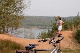
The pearl of Duinengordel is the Oudsberg: the highest and largest open shifting dune of Flanders. It rises 85 m above sea level. The Oudsberg is surrounded by beautiful heath lands, stately forests and butterfly-rich grasslands.
At the top, a magnificent panorama awaits you. In recent years, the nature reserve has undergone a 'facelift' to increase its biodiversity. So you get the same view as before: dunes with heather, a lot of sand, some trees and all that surrounded by a forest belt. Dune belt is sandy and dry. An exception to this sandy and dry character are the fens: Ruiterskuilen, Turfven, Zwartven and Schaapsven. Like an oasis in the desert, these fens have a special attraction to plants and animals. On www.duinengordel.be you will find more information about this beautiful area.
Photo: Erwin Christis
Practical info
Currently, there are 4 reception points where visitors can go for more information about Duinengordel and from where they can start their visit to the area:
Commandery Gruitrode (Oudsberg region):
Walking routes of 3.9 km | 9.2 km | 14.6 km
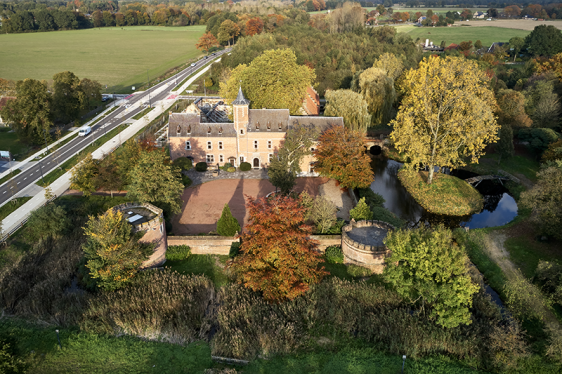
Until 1801, the Commandery Gruitrode was one of the twelve commanderies of the Teutonic Order subservient to the Commander of Alden Biesen. The Commandery consisted of a castle separated by moats and a square farmstead. The importance of the Commandery is shown, among other things, by the fact that coins were minted in Gruitrode and Gruitrode grew into an important regional trade centre. Phased restoration of the site began in 2024. In addition to being a hotspot for culture and events, Commanderij Gruitrode will also be further developed as a gateway to the Hoge Kempen National Park.
In summer, you can enjoy the pop-up summer bar Kaffee Command here. There is ample parking for cars and bikes and, of course, you will also find an info board with the hiking routes you can start here.
Info.
Commandery Gruitrode
Kasteelstraat 2, 3670 Gruitrode (Oudsbergen)
Orshof in Neerglabbeek (region of Solterheide):
Walking routes of 5.6 km | 9.8 km | 12.6 | 13.3 km
This Kempen farm, located on the edge of Duinengordel, houses a restaurant and seminar centre. You can stay overnight in the cosy guest rooms. There is also a large garden with a pond, a riding school, bike rental and the possibility of charging your electric bike. It is the ideal base for horse riders, drivers and mountain bikers. You can also get there by bike or on foot.
Info:
Heymansweg 2, 3670 Neerglabbeek (Oudsbergen)
T: +32 89 81 08 00 - E: info@orshof.be
www.orshof.be
Opening hours: open every day
Reception point Zavelbos in Opoeteren (Oudsberg region):
Hiking routes of 3.3 km | 7.1 km | 9.4 km | 14.6 km
Camping Zavelbos is nestled between the woods and fens of Duinengordel. The ideal starting point for a walk to the Oudsberg, but also for various cycling, riding and mountain biking routes. After your tour, you can laze around at the playground, unwind at the campsite with its beautiful pond or satisfy your hunger at the tavern.
Info:
Kattebeekstraat 1, 3680 Maaseik - 4 charging stations available
T: +32 89 75 81 46 - E: zavelbos@limburgcampings.be
www.zavelbos.be
Opening hours: open every day
Sentower Park welcome point in Opglabbeek (Donderslag region):
Walking routes of 4.6 km | 8 km | 15.7 km
This equestrian centre connects directly to the forests and fens of Ophovenderheide. The Oudsberg is just a stone's throw away. The spacious car park is ideal as a starting point for riders. You can also charge your bike here or enjoy a snack and a drink in the equestrian café in the central hall or on the terrace during events.
Info:
Leemkuilstraat 21, 3660 Oudsbergen (Opglabbeek)
T: +32 89 36 43 17 - E: info@sentowerpark.com
www.sentowerpark.com
Opening hours: The equestrian café in the central hall is open almost 7/7. The terrace is only open during training sessions, competitions and events.
What to do?
Gruitrode Commandery
The Commandery of Gruitrode, a guard castle from the 15th century, is being revived. It will become an exciting meeting place for every visitor with a heart for nature, culture and heritage! The site will undergo a thorough metamorphosis into a fully-fledged ‘Gateway to the Hoge Kempen National Park’. In summer, you can enjoy the pop-up summer bar Kaffee Command here. There is ample parking for cars and bikes and of course an information board with the hiking trails you can start here.
More info on the planning of these works can be found here.
Kasteelstraat 2, 3670 Gruitrode (Oudsbergen)
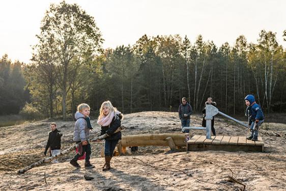
Joekelbos, the largest play forest in Flanders
Flanders' largest adventure play forest: 10 play elements, wooden animals, play dune with water and hide huts invite you to romp!
The paved part of the path is accessible for wheelchairs and prams.
Where?
Speeltuinstraat, 3660 Oudsbergen (Opglabbeek)
By bicycle between nodes 526 and 527
Download the map
Photo: Kris Thijs
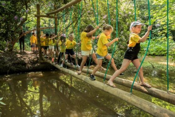
Multimovepad: romping around in greenery
The signposted Multimovepad in park Itterdal, of about 2 km, starts at the Care Café Itterdal. Through the springbok trail, suspension bridges, the ducking frame, the balance beam, the climbing forest, the long jump box, the balance box, the rings and the climbing nets, children learn to climb, jump and land, slide, hit, pull and push, walk and run in abundance.
Where?
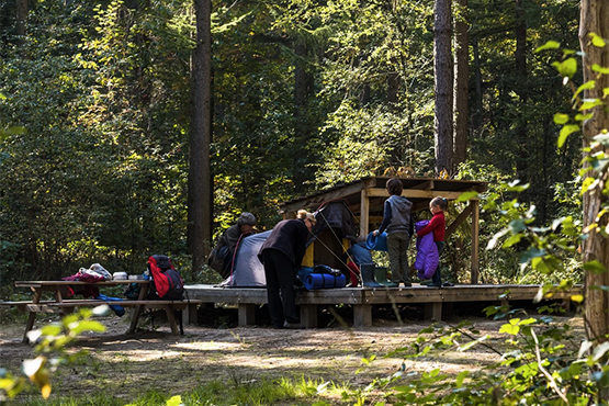
Pole camping
Pole camping sites Itter and Solt are located in the middle and at the edge of the woods in Solterheide. You will find a tent platform, a water pump, picnic bench and shelter.
Accessible via Great Route path (GR) 561 Kempen-Maaspad between Opitter and Neeroeteren. Both areas are only 700 to 800 metres apart via forest paths.
GPS coordinates: Itter: N 51 06.283 E 5 39.200 - Solt: N 51 05.983 E 5 39.183
Picnic decking by the water
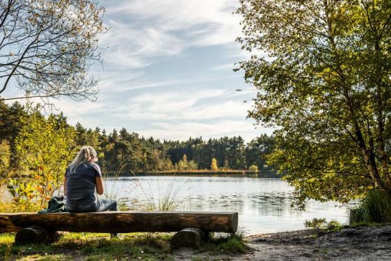
Picnic decking by the water
In Duinengordel, you will find a few pearls of picnic spots near the walking and cycling route network.
Where?
Ruiterskuilen (Opglabbeek): between junctions 33 and 70 or via the yellow and blue walking loop in the Donderslag walking area.
Bosbeek (Opoeteren): between nodes 37 and 38.
Photo: Kris Thijs